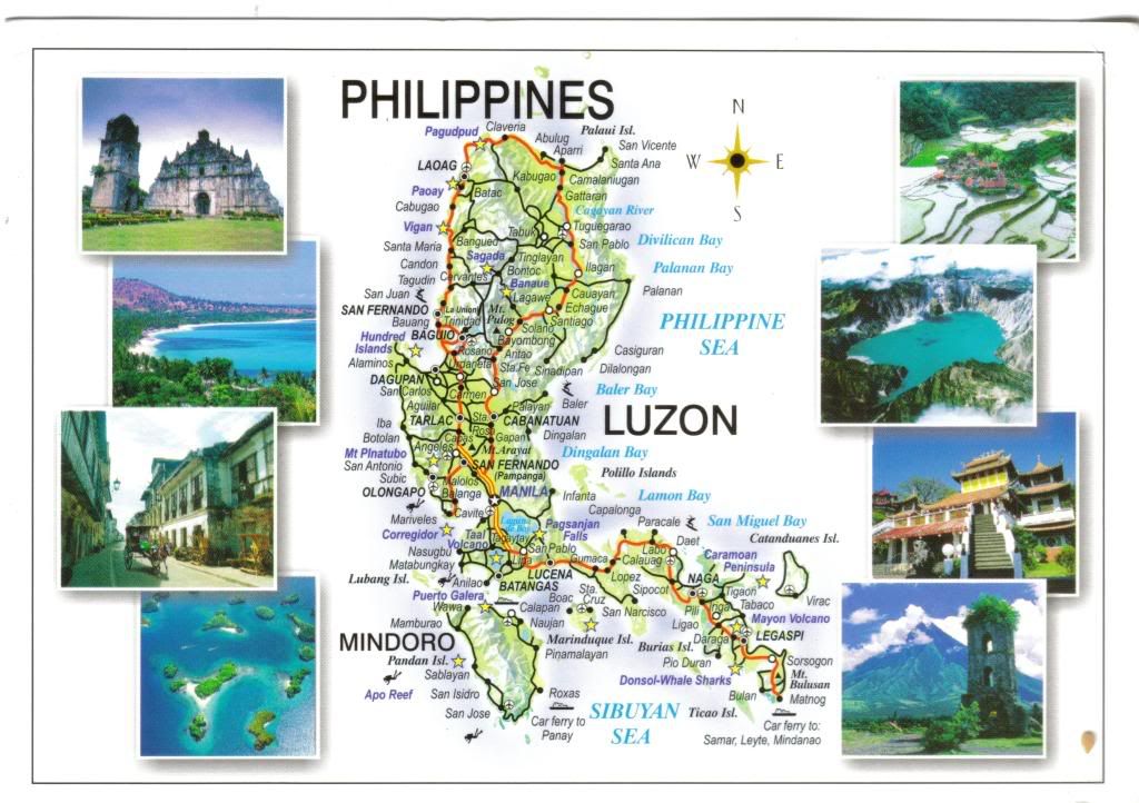
Here you can see the island of Luzon, which is the largest and most economically and politically important island in the Philippines and one of the three island groups in the country.
It includes a number of islands, including Mindoro, which you can see on the card as well...its south of Luzon.
Quezon City, the former capital and most populous city in the Philippines, is also located on the island of Luzon. (now, Quezon City rings a bell of something..:-)))))))
Lets see the pictures on the card now, starting from the left first:
- Paoay Church, Ilocos N.
- White sand beach and azure blue waters of Pagudpud......mmmmmmmmmmmmmm
- Vigan, a Spanish heritage city
- Hundred Islands National Park, Pangasinan
on the right side:
- Century old Banaue Rice Terraces
- Crater of Mt. Pinatubo, Pampanga
- Taoist Ma-Cho Chinese Temple in San Fernando, La Union
- Mayon Volcano, Albay
that crater picture looks amazing!
No comments:
Post a Comment